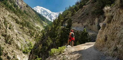
Fairy Meadows remains one of Pakistan’s most sought-after trekking destinations this year, drawing thousands of domestic and international hikers to the base of Nanga Parbat. Travellers are increasingly searching for a reliable Fairy Meadows trekking map, updated trekking distance figures, and a clear breakdown of Fairy Meadows trekking price before booking their trip. This guide lays out the full Fairy Meadows trekking itinerary, realistic Fairy Meadows trekking cost estimates, and what makes the Fairy Meadows night view so widely photographed by visitors.
Background
Fairy Meadows sits in the Diamer district of Gilgit-Baltistan, at an elevation of roughly 3,300 metres, directly beneath Nanga Parbat, the ninth-highest mountain in the world. Locals traditionally call the meadow “Joot,” while the English name is believed to have been given by early European explorers who were struck by its untouched, dreamlike scenery. Over the past decade, improved road access along the Karakoram Highway has turned what was once a remote mountaineering approach into one of the country’s most popular short treks. The route has grown popular because it offers high-altitude mountain scenery without requiring the technical skill or multi-week commitment of a full expedition. Any accurate Fairy Meadows trekking map shows the journey beginning from Raikot Bridge on the Karakoram Highway, continuing by jeep to Tatu village, and finishing with a foot trek through pine forest to the meadow itself.
Details
Fairy Meadows Trekking Map and Route
A typical Fairy Meadows trekking map starts at Raikot Bridge, roughly 12 kilometres before Chilas town when travelling from Islamabad. From the bridge, a rugged jeep track climbs steeply up the mountainside to Tatu village, which sits well above the Indus River valley. This jeep section alone gains significant elevation and is considered one of the more thrilling parts of the journey by most visitors. From Tatu village, the trekking map shows a forest trail winding upward through pine and birch trees until it opens onto the meadow. Many trekkers also extend their route beyond Fairy Meadows itself, following connecting trails to Beyal Camp, Nanga Parbat Base Camp, and Reflection Lake, all of which appear on extended versions of the regional trekking map.
Fairy Meadows Trekking Distance
The Fairy Meadows trekking distance from Tatu village to the meadow itself covers roughly 3 to 4 kilometres of trail, though the walk typically takes between two and four hours depending on a hiker’s fitness and pace. This section is the only stretch that must be covered on foot, since the earlier leg from Raikot Bridge to Tatu is completed by 4×4 jeep. For travellers coming from further afield, the overall Fairy Meadows trekking distance is far longer. The road journey from Islamabad to Raikot Bridge alone covers close to 480 kilometres along the Karakoram Highway, usually broken into an overnight stop at Chilas. Those extending their trip toward Nanga Parbat Base Camp add another 12 to 14 kilometres of additional trekking distance beyond the meadow.
Fairy Meadows Trekking Price and Cost
The Fairy Meadows trekking price varies widely depending on whether travellers arrange transport, guides, and camping independently or book a packaged tour. Independent budget travellers can often complete the trip for a modest daily cost covering jeep fare, basic guesthouse or camping accommodation, and meals sourced locally in Tatu or the meadow itself. Guided multi-day packages that include transport from Islamabad, meals, camping equipment, and a local guide generally carry a higher Fairy Meadows trekking cost, reflecting the logistics of reaching such a remote area. Group bookings usually bring the per-person price down, while solo travellers or small parties tend to pay more for the same jeep and guide services. Prices also shift seasonally, with the main trekking season running from May through October and shoulder-season months sometimes offering lower rates. Beyond the core trek, day hikes from Fairy Meadows to nearby viewpoints and Nanga Parbat Base Camp are usually charged separately if a guide is hired, since local operators price these add-on treks according to distance, altitude gain, and difficulty.
Fairy Meadows Trekking Itinerary
A standard Fairy Meadows trekking itinerary spans four to six days, depending on how much time travellers want to spend acclimatising and exploring side trails. Most itineraries follow a similar structure: The first day typically covers the long drive from Islamabad to Chilas along the Karakoram Highway, with an overnight stop to break up the journey. The second day involves the drive to Raikot Bridge, the jeep ride up to Tatu village, and the trek into Fairy Meadows itself, where trekkers usually camp for the night. Days three and four are generally reserved for exploring the meadow and its surrounding trails, including short walks to Reflection Lake and longer day hikes toward Beyal Camp or Nanga Parbat Base Camp. The final days of the itinerary retrace the route back to Chilas and onward to Islamabad, often with a stop at Taxila’s archaeological sites for travellers with extra time.
The Fairy Meadows Night View
Among the biggest draws of the trip is the Fairy Meadows night view, which regularly appears in traveller photographs and social media posts. With minimal light pollution at this altitude, the night sky over the meadow reveals dense star fields, and on clear nights the silhouette of Nanga Parbat is visible under moonlight from the camping grounds. Visitors staying overnight in tents or wooden huts consistently describe the Fairy Meadows night view as one of the trip’s most memorable moments, distinct from the daytime mountain views that draw most trekkers there in the first place. Local camp operators note that clear-sky nights between June and September tend to offer the best visibility for stargazing and mountain photography.
Quotes
Trekking guides operating in the Fairy Meadows area say demand for the trek has grown steadily in recent trekking seasons, with more travellers specifically requesting itineraries that include an overnight stay to catch the night view of Nanga Parbat. Local camp operators in Tatu and Fairy Meadows also point out that jeep and guide pricing is reviewed each season to reflect fuel costs and road conditions along the route from Raikot Bridge. Tourism promoters in Gilgit-Baltistan have repeatedly highlighted Fairy Meadows as a flagship destination for showcasing the region’s trekking potential to both domestic and international visitors, citing its relatively short and accessible route compared to other high-altitude treks in the province.
Impact
The steady rise in Fairy Meadows trekking has had a noticeable regional impact, supporting jeep drivers, porters, guesthouse owners, and camp operators in Tatu village and the surrounding Diamer district. This trek has become an important source of seasonal income for local communities who depend heavily on the May-to-October tourist window. On a broader level, the growing popularity of treks like this one contributes to Pakistan’s wider push to promote adventure tourism in Gilgit-Baltistan, an area increasingly marketed internationally for its accessibility relative to other Himalayan and Karakoram destinations. Increased footfall, however, has also raised concerns among conservation groups about waste management and trail erosion, prompting calls for more organised eco-tourism practices in the meadow.
Conclusion
As trekking infrastructure along the Karakoram Highway continues to improve, Fairy Meadows is expected to remain one of Pakistan’s most searched and most visited trekking destinations in the coming years. Future development is likely to focus on better waste management, regulated guide pricing, and expanded camping facilities to accommodate rising visitor numbers without damaging the fragile alpine environment. For now, travellers researching the Fairy Meadows trekking map, distance, price, and itinerary can expect the route to stay largely consistent with previous seasons, with the meadow’s night view continuing to be one of its biggest draws.
FAQs
Is Hunza better or Fairy Meadows?
This comparison really depends on what a traveller is looking for. Hunza offers a wider range of accessible sightseeing, including lakes, forts, orchards, and scenic drives that suit travellers who prefer comfort and variety without heavy trekking. Fairy Meadows, on the other hand, is built around a single dramatic experience: reaching a high-altitude meadow directly beneath Nanga Parbat after a jeep ride and forest trek. Trekkers seeking close-up mountain views and a genuine wilderness camping experience generally rate Fairy Meadows higher, while those wanting a broader, easier valley tour with more amenities tend to favour Hunza. Many seasoned travellers in Gilgit-Baltistan actually recommend combining both destinations in a single extended trip rather than choosing one over the other.
Is K2 visible from Fairy Meadows?
No, K2 is not visible from Fairy Meadows. The meadow sits in the Nanga Parbat massif in the western Himalaya, while K2 rises in the Karakoram range further north, near the Baltoro Glacier in Gilgit-Baltistan’s Skardu region. The two peaks are separated by a significant distance and different mountain systems, meaning no viewpoint around Fairy Meadows offers a direct sightline to K2. Trekkers hoping to see K2 typically need to travel toward Concordia or the Baltoro Glacier trekking routes instead, which are entirely separate multi-week expeditions from the Fairy Meadows trek.
What is the most challenging trek in Pakistan?
Pakistan is home to several demanding treks, and the “most challenging” title is usually given to the Baltoro Glacier trek to K2 Base Camp and Concordia, a multi-week high-altitude expedition through the Karakoram range. This route involves extended glacier walking, high-altitude camping, and significant acclimatisation requirements that place it well beyond the difficulty of shorter treks like Fairy Meadows. Other routes frequently mentioned among Pakistan’s toughest include the Snow Lake (Biafo-Hispar) traverse and various technical approaches to Nanga Parbat’s higher camps, both of which demand serious mountaineering experience, proper equipment, and professional guiding support.